VFR flying demands a bizarre mix of meticulous planning and a penchant for spontaneity. I learned that over Labor Day weekend when my girlfriend and I set out one morning for a vacation in South Dakota’s Black Hills and instead ended up in Boulder, Colorado.
It was late August, and after a busy AirVenture I was enjoying what was left of summer. I was itching for one last flying adventure before settling into the slide toward frosty air and scant daylight here in Wisconsin. Although I’m a native New Englander, I’ve always been fascinated by the stark beauty of the Great Plains and relished an opportunity to fly west. My girlfriend, Lily, loves a good flying adventure, too, and quickly agreed to come along. We booked the RV-6A from the EAA Employee Flying Club and set about planning for the trip.
Lily and I set our sights on the South Dakota Badlands and the Black Hills because I had never been there and with any reasonable weather the region would be achievable within a day’s flight in the RV. We agreed that if the conditions were ideal, we would spend Friday night in Minneapolis with Lily’s parents, fly to South Dakota on Saturday, and return Monday.
In my experience, the weather before any highly anticipated cross-country flight seems to have a sense of irony — it’s pristinely beautiful along the route of flight right up to your departure window, upon which it suddenly turns questionable. This trip was no exception. High pressure dominated the northern Plains for days before our flight, but Sunday and Monday were forecast to yield marginal weather or worse. We resolved to be flexible, which flying little airplanes demands. Saturday looked flyable, so if the weather for the weekend took a turn for the worse we would a make a good day of it and return to Oshkosh early. Maybe see Mount Rushmore from the air and then head back east, ahead of any storms.
On Thursday and Friday I monitored every type of weather forecast I could get my hands on. It was still an uncertain picture for Sunday and Monday, but Friday and Saturday looked good. We decided if the weather out west tanked, we’d still have a good time in the Twin Cities. After all, the Minnesota State Fair was in its final days, so we could always go and sample something fried and on a stick.
Friday
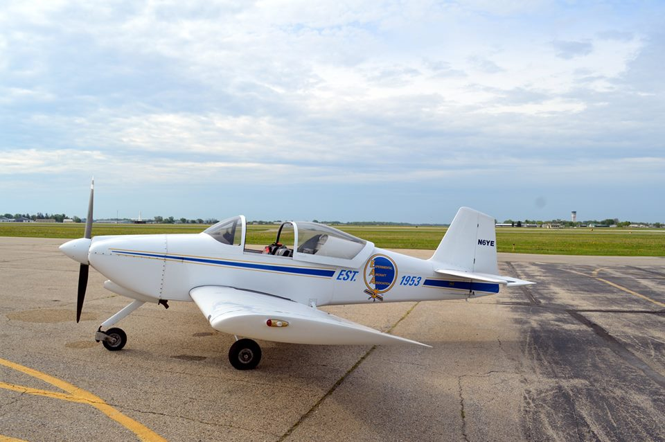
Two weeks of planning and fretting came to an end and it was time to begin the journey in N6YE. On Friday I arrived at the hangar after work, performed an extra-thorough preflight, and headed out.
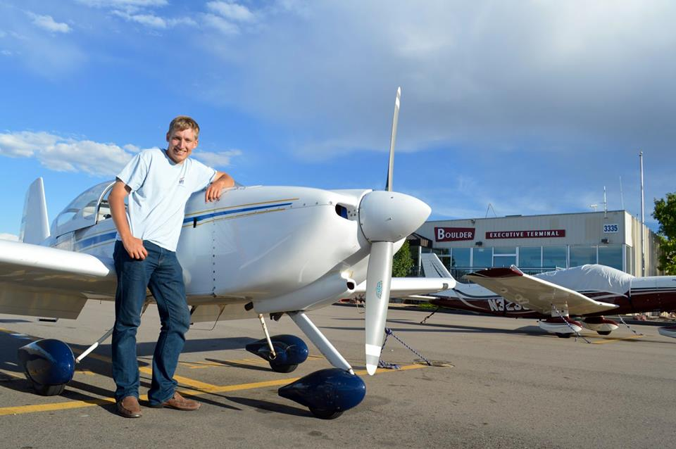
Six Yankee Echo
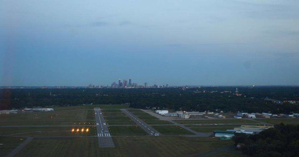
After a brief stop at Morey Field in Middleton, Wisconsin (C29) to pick up Lily, we headed toward the Twin Cities. As we passed the hilltop farms of the Driftless Area and the barges on the Mississippi it felt like the last swing around our home neighborhood before a long road trip to somewhere new. Soon enough we were in the pattern at Crystal Airport (MIC) and touched down shortly before sunset.
The Minneapolis skyline at sunset
That evening the weather picture began to solidify, and the end of the weekend was not looking good for the Rapid City area. As we began to consider alternatives, a thought occurred to us that hadn’t before: Although the northern Plains looked set to give us grief for our planned return, a southerly route across Colorado, Nebraska, and northern Kansas looked fine. We were confident in our abilities to salvage a good adventure out of any diversion that might arise.
Saturday
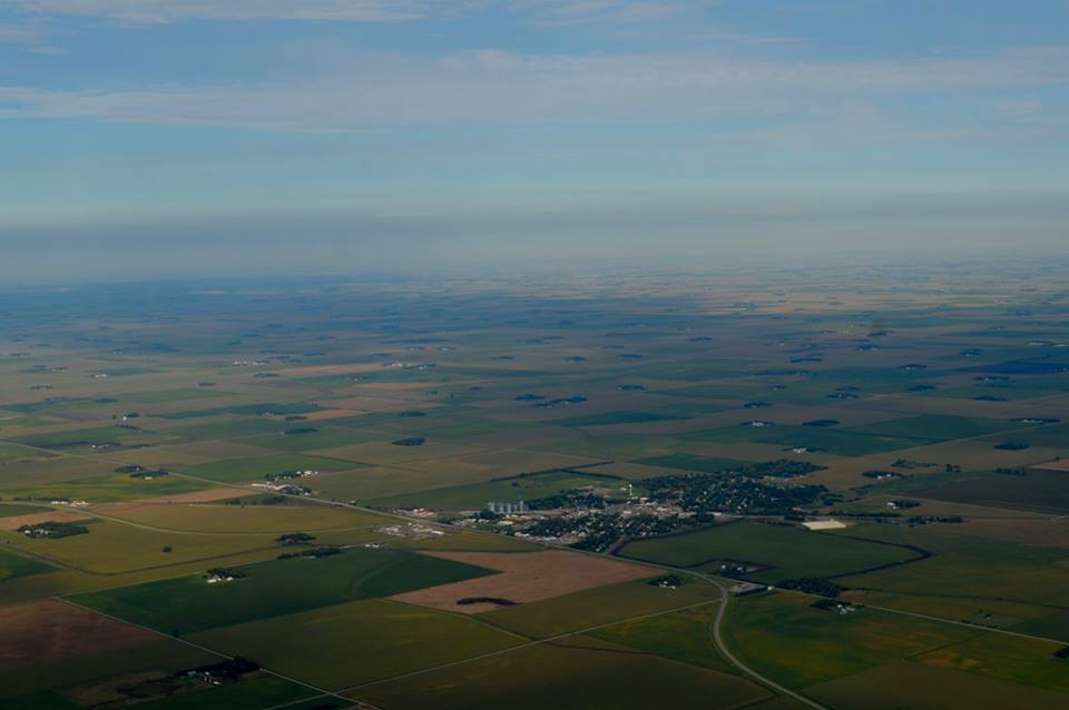
We left Crystal around 7:30 a.m., prepared for a long day. The urban sprawl of Minneapolis quickly melted back into Midwestern farmland. Here, like much of America’s heartland, the roads form a grid along the cardinal points of the compass. The late summer crops showed off their brilliant greens and yellows, dotted by cozy, treed-in farmsteads. Occasionally, intersections in the road grid swelled to accommodate a grain elevator, a railroad siding, or sometimes a factory or two with an accompanying small town.
A western Minnesota town rises out of the farmland
Our first tank of gas took us to Canby, Minnesota (CNB), near the South Dakota border. It wasn’t too late in the morning, but ASOS was already reporting blustery surface winds. As we neared the ground it became clear it would be a difficult landing. There was indeed a gusty crosswind, and to make matters worse there was a line of trees along the windward side of the runway, ready to force a last-minute adjustment in my flare. I dialed in as much aileron correction as I could and corralled the RV on the centerline as it decelerated. Nothing like a tough crosswind landing to keep your ego in check.
After a splash-and-dash in Canby, we entered South Dakota. Even though arbitrary boundaries like state lines are usually invisible from the air, the landscape was undeniably changing. The Midwest was yielding to the Great Plains. The ground became hillier, the farmland more rugged and the towns more sparse. After our experience in Canby, I was becoming more concerned about the wind, as the ADS-B started to show gusts creeping through the high 20s. The weather in Rapid City looked good, however, and its 8,700-foot runway was within our flying range even without a stop. We pressed on.
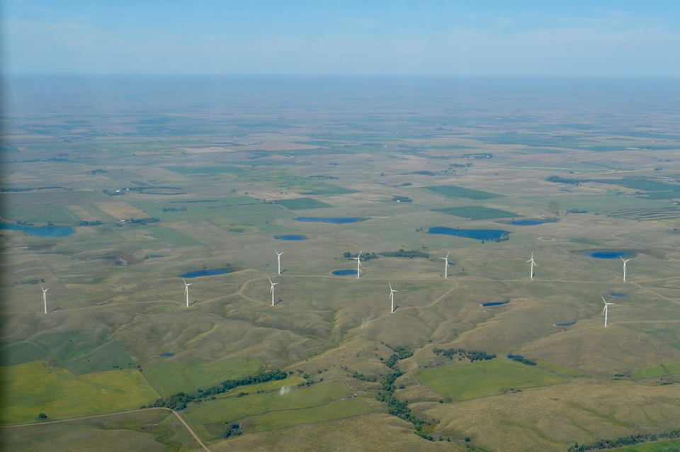
A hilltop windfarm works furiously on a blustery day
As we flew deeper into South Dakota, the brief drama of high surface winds subsided. We took the opportunity to land in Chamberlain (9V9), a small town where Interstate 90 crosses the Missouri River. While still gusty, the winds were straight down the runway and we landed without too much trouble.
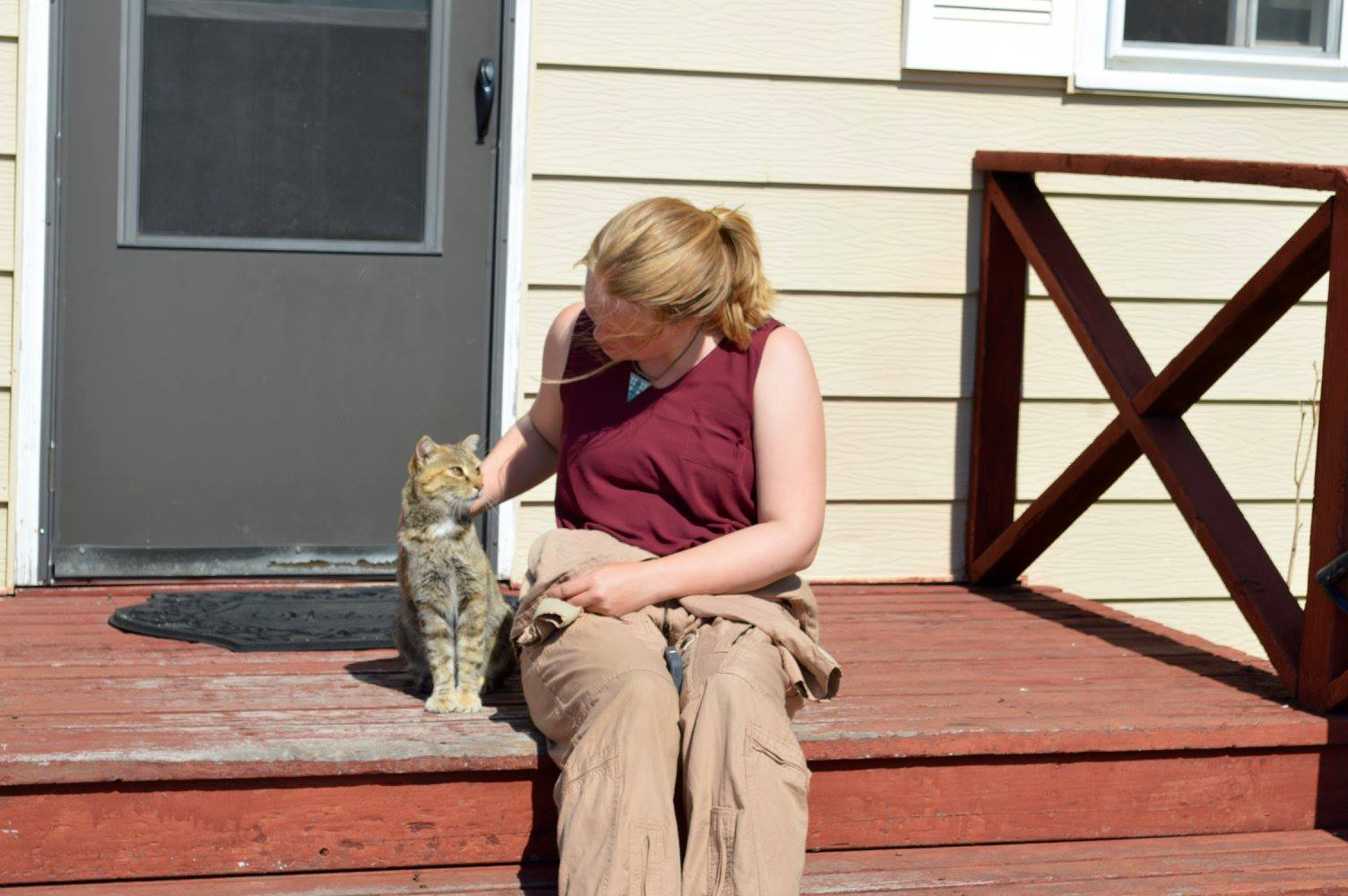
Lily and the airport cat
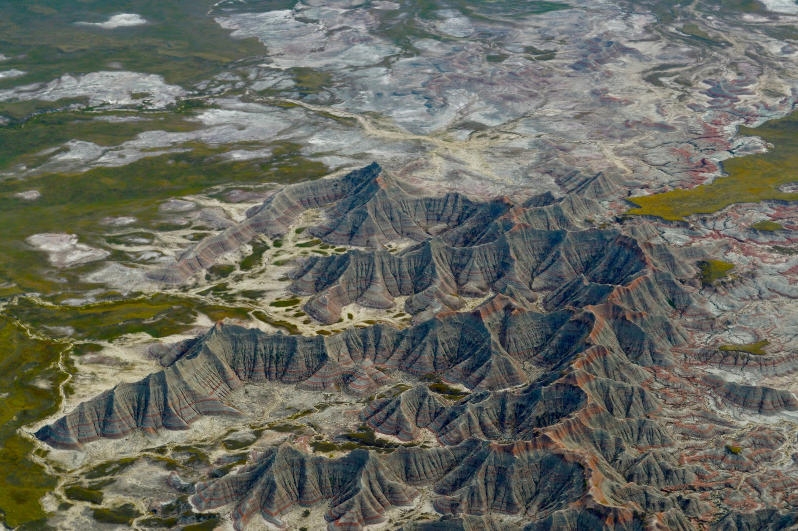
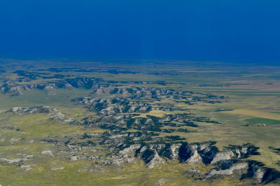
After our stop, we entered the Badlands, and for the next hundred-odd miles were treated to an endless display of surreal beauty. Eroded rock faces began to emerge, peeking out from beneath the soft carpet of prairie grass and scrub. The rolling hills soon gave way to valleys and spires. Alternating stripes of brilliant white and rust-red rock cut across the winding landscape with precision. It is a bit humbling to look upon 75 million years’ worth of history in a single glance. Volcanic ash, clay from the seabed of ancient oceans, and sediment from early wandering rivers together form the strikingly beautiful terrain.
The scale of The Badlands is difficult to capture
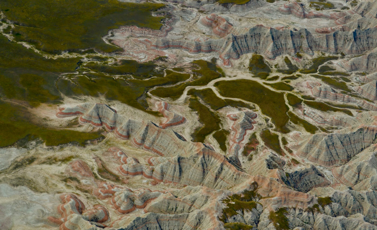
Stratified rock turns the landscape into a life-sized topo map
Unfortunately, all this gawking and picture-taking of the ground below, combined with some afternoon thermals and steep banks to set up photos, took its toll on Lily. She spoke up quickly and I immediately handed control off to her. Luckily, we were almost to our planned lunch stop.
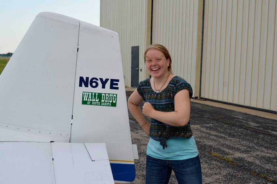
With Wall Drug, an icon of the West, along our route, how could we pass up making the pilgrimage? The tiny roadside hamlet is home to a sleepy airport (6V4) that supports several agricultural spraying operations. A waist-high barbed wire fence rings the airport, not out of post-9/11 security theater, but to guard against wayward cattle. We were able to walk from the airport to “downtown” Wall.
Over lunch, as planned, we made our decision about where to spend the remainder of the long weekend. The forecast for Rapid City was still IFR for most of Monday, but Colorado looked great. Flying south did present a more immediate problem in that there were some scattered thunderstorms making their way across the area that afternoon, but the cells seemed isolated enough to provide ample VFR between them, and plenty of warning before we encountered them.
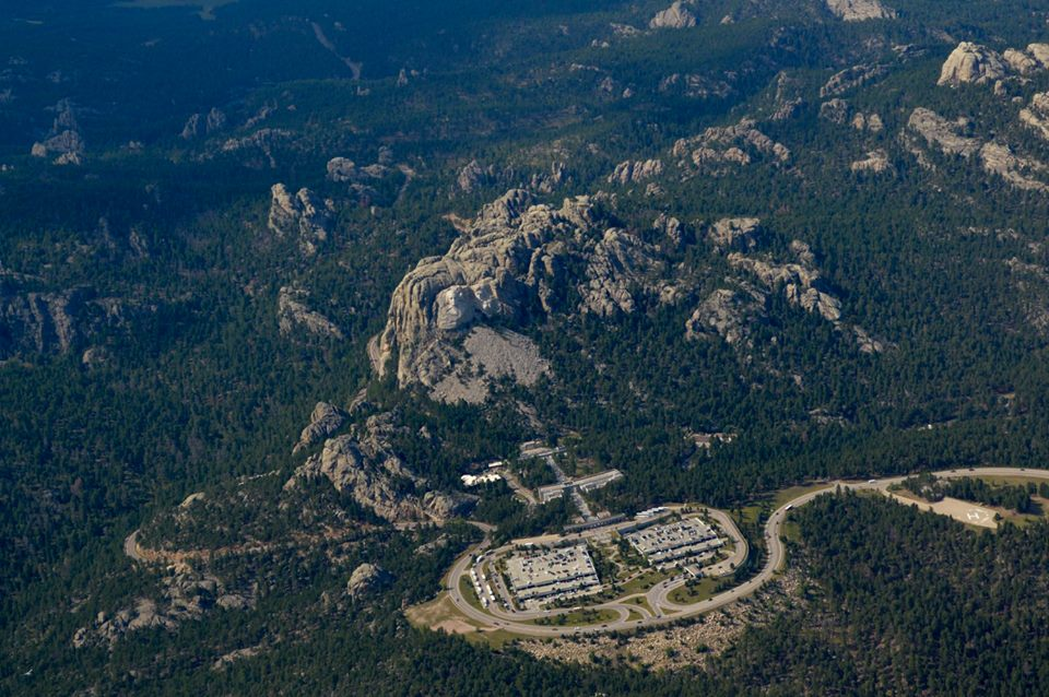
After flying this far across South Dakota, however, we weren’t going to head south without first seeing the Black Hills. After a quick jaunt around the south of Rapid City, we entered the green, rocky highlands. At the top of our sightseeing tour was Mount Rushmore, which we quickly found thanks to a helpful mark on the sectional chart. We kept our distance and our altitude, but the massive monument was still an impressive sight from the air. After snapping a few photos, we turned left and headed for Boulder.
Mount Rushmore
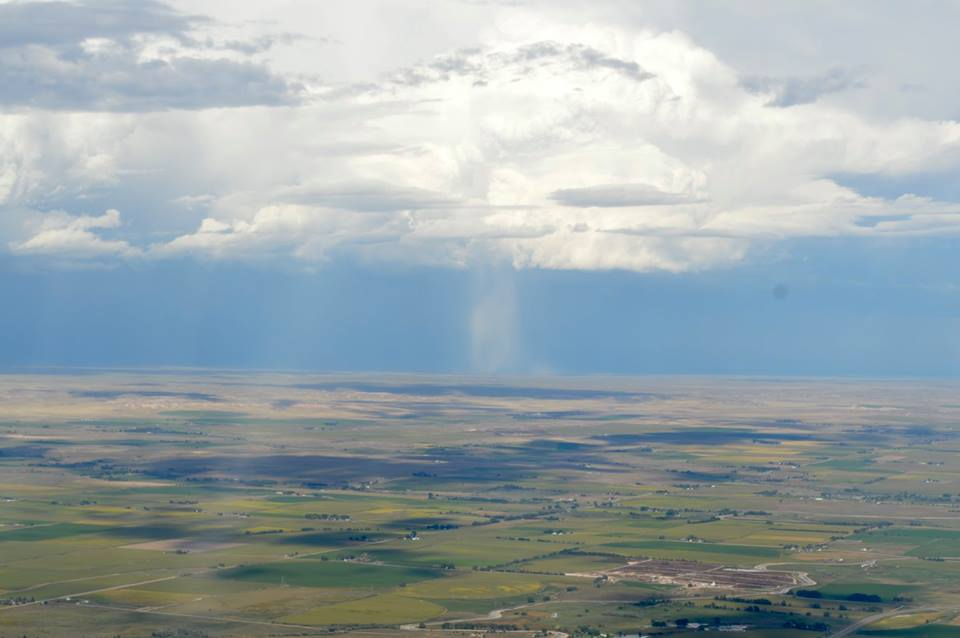
The picturesque airport at Hot Springs, South Dakota (HSR), was our last fuel stop before the run south. Travelling across Wyoming and the Nebraska panhandle there were two storm cells in our path moving west to east, but as expected there were miles of blue sky between the cells and in front of us. With the aid of inflight weather from our ADS-B connection, we pressed up against the back of the eastern cell to allow maximum separation from the western one. This provided for some very dramatic lighting of the landscape, but the visibility remained fine. We were never really close to the cell advancing on us as we traversed a generous corridor of blue sky, but we shot more than a few nervous glances to our right and kept an airport within reach. The weather in the cell to our left was quite impressive, and we even caught what we believe was a microburst on film. It looked as though the bottom fell out of the clouds, and while it was distant we were thankful we weren’t any closer!
Looking into the retreating cell, heading south
A microburst?
As we entered Colorado it appeared as though the trickiest weather was behind us. It was also apparent that we had left behind the canyons and hills of South Dakota and were once again over the flat Plains. This time, instead of lush Midwestern farmland, we were over a grassy, arid steppe pockmarked with oil wells. Looking ahead on the NEXRAD radar, we were clear all the way to Boulder. So we lined up the greater Denver area in our sights and pressed on.
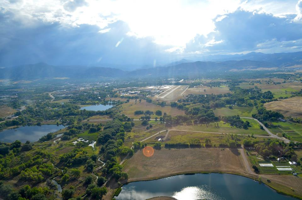
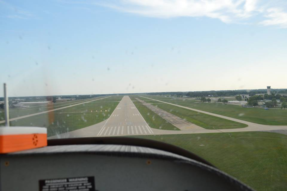
Then we saw them. First appearing as a ghostly silhouette through the haze, the Front Range of the Rockies came into view. The giant dividing wall of the continent was final confirmation that we had accomplished our day of flying. There was nothing left to do for us than to enjoy the last few miles of our journey, navigate around Denver’s Class B airspace, enter the pattern at Boulder (BDU), and land. All told, we had spent about eight hours aloft.
Arriving in Boulder
We tied down the airplane and called a cab to a hotel. In addition to the usual fatigue of a long day in the air, we were bewildered that we had made it to Boulder! That morning we had set out from Minneapolis with only a vague idea of where we would go, and we managed to cross a wide swath of the country in little Six Yankee Echo. We explored in a single day what would probably have accounted for several weeks’ worth of road trips. General aviation is a true privilege, and it’s trips like these that remind you to never, ever take it for granted.
End of a long day
Sunday
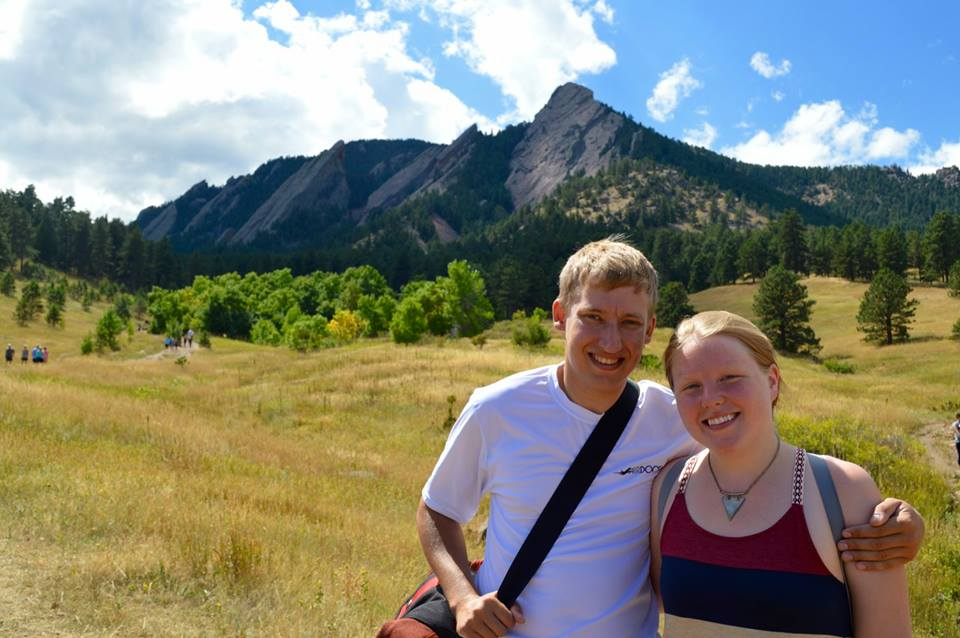
Boulder is one of the best places we could have dropped into on short notice. Lily and I are both amateur “foodies” and outdoors enthusiasts, so we set about finding the best food we could for every meal and in the afternoon we took a hike around the Flatirons.
Hiking in the Flatirons
We didn’t start the weekend planning to wind up in Boulder, but we were glad we did. It is a beautiful city that is easy to explore, and we look forward to going back!
Labor Day
The return journey on a trip like this is usually the less dramatic part. The excitement and wonder of pushing out into new territory is replaced with the urge to get home, and the aches and cramps associated with spending two out of three days in a cockpit begin to set in.
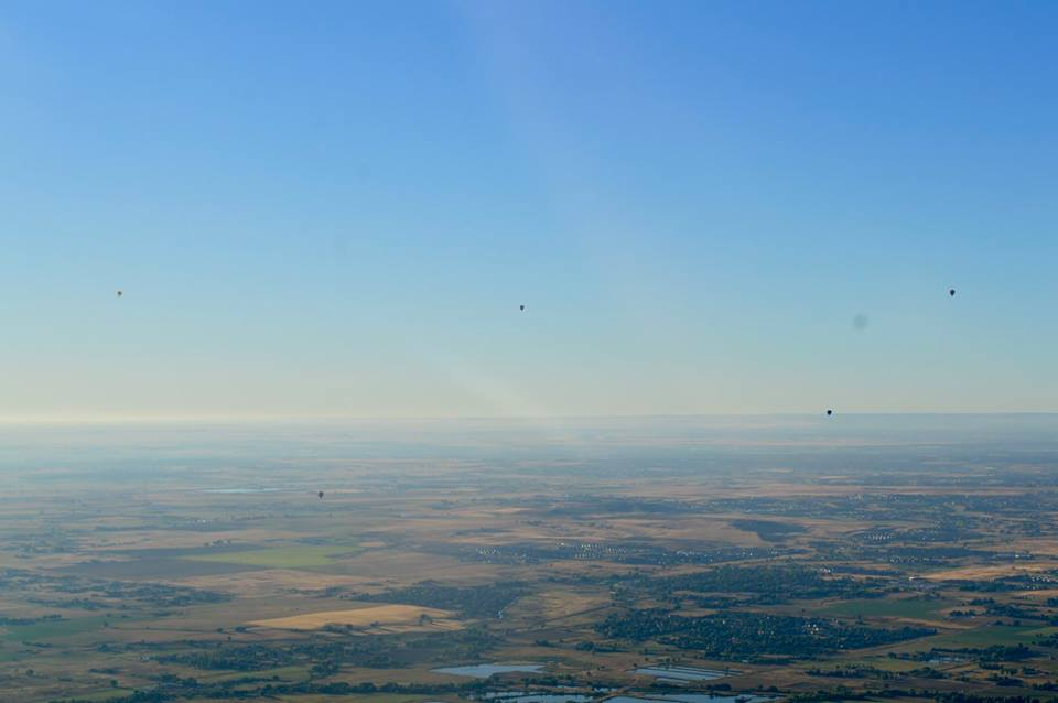
We left Boulder around 7 a.m., climbing beneath Denver’s airspace and past a group of balloonists enjoying the calm morning air. Ahead of us was a shelf of low-lying fog that forced us south as we entered Nebraska, but otherwise the sky was clear. We were already picking up a strong tailwind and we didn’t even have to climb too high to get it — the strongest winds were no higher than about 7,500 feet. After two hours of flying we arrived at our first fuel stop of McCook, Nebraska (MCK).
Encountering hot air balloons leaving Denver
For the second leg of our return trip, we took the RV up to altitude across the rest of Nebraska, over Omaha, and into Iowa.
Our last fuel stop was Ankeny, Iowa (IKV), a Des Moines suburb where we met a few of Lily’s college friends for lunch before heading back to Wisconsin.
Following the Wisconsin River
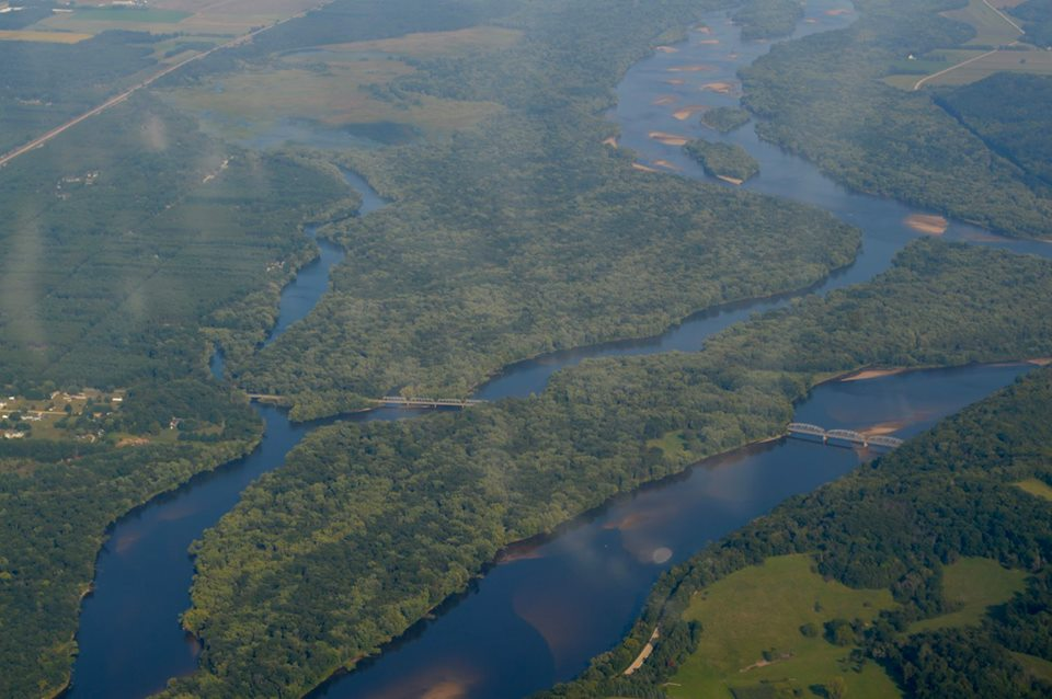
The last leg of a trip like this is always bittersweet. You want to get home, you want to get out of the cockpit, but in a small way, you don’t want it to end. We crossed into Wisconsin near Prairie du Chien, where the Wisconsin River meets the Mississippi. We were back in the Driftless Area, a region of rolling hills in southwestern Wisconsin and parts of Iowa and Minnesota. It’s one of our favorite places to fly over in this part of the country, and we made the decision to take a slight detour and drop out of our cruising altitude so we could follow the Wisconsin River. We traced the bends and curves of the sandy waters to Portage, and then left the river and flew northeast until it was time to call the tower in Oshkosh and bring this journey to a close. It was just before 5:30 p.m. The return flight, including our nearly two-hour lunch stop, had taken about nine hours. Not bad for our little RV-6.
The last few seconds of the trip
Some Final Thoughts
There are a few key points that we came away with. Some are new lessons learned, some reinforce what we already knew. Here are a few:
-The limitations of GA trip planning: You can guarantee being somewhere at any time or anywhere at some time, but you can’t guarantee being in a specific place at a specific time. If there are tight limitations on your trip, your best chance is with an airline ticket. In our case, we had a finite amount of time to make this trip, so we built the route around the areas with the best weather and were flexible about our destination.
–The value of inflight weather: Datalinked weather has limited utility as a “tactical” tool (it is well documented that data such as radar mosaics can be fairly old by the time they reach the cockpit), but it can definitely aid situational awareness, conveying weather trends, forecasts, and problem areas to the flight crew. Our ADS-B weather gave us peace of mind on the leg from Hot Springs to Boulder, as we were able to confidently give the cells a wide berth. On other legs, it was good to be able to glance at weather data such as METARs without using the radio.
–The importance of spontaneity: This is related to my first point — you have to roll with the punches in general aviation. A vagabond’s willingness to secure housing, transportation, good food, and entertainment, no matter where you wind up, is an important asset to have. Nowadays this is easier due to smartphone apps and websites.
In the end, we covered more than 1,700 miles in about 72 hours of a long weekend without using any vacation time. We saw a large expanse of this vast, beautiful nation, and explored a little gem of a city on the edge of the Rockies, all with the satisfying feeling of accomplishment that comes with flying there yourself. It was a wonderful, spontaneous trip, and we can’t wait for the next one.
Oh, and remember Wall Drug? Well, every respectable Midwesterner knows that no visit to the famous store is complete without affixing an official Wall Drug bumper sticker to your vehicle. So, of course, we obliged.